Expanding My Horizon
It’s been a while since I last blogged on my blog. One of the many things I’ve been up to recently is learning how to fly. As a member of a local aeroclub I can now take an airplane to the sky and literally expand my horizon!
To find out exactly how much expandin’ is really possible, I hacked together some Javascript that allows me to enter different cruise speeds (in knots) and endurances (in hours) and overlays it on Google Maps. Here’s a screenshot:
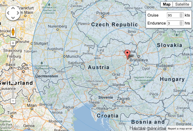
Needless to say this is a very rough estimate as it doesn’t take any air space restrictions, terrain, weather, climbs or descents into consideration, but it’s still fun to enter different aircraft’s performance characteristics and imagine where they would take me :)
This was the first time I used the Google Maps API and I have to say that it is really simple and easy to use. It works well and the documentation is good.